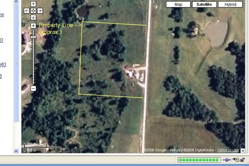
 I like to goof around on Google Maps sometimes, see if it can zoom in close enough to see cars & stuff like that. OK, you knew I was a nerd already, right? The hybrid map/satellite imagery is particularly cool, but unfortunately, the satellite images are often a year or two out of date. Well, it's a big planet, I guess they get around to updating it as often as they can.
Anyway, I googled the dome site the other day, and behold! The dome now shows up! Or, at least, the basement walls do. The image must have been taken on a sunny day in late May or early June of last year, sometime between when the dome kit was delivered (you can see it stacked up between the structure & the road) and when the frame went up. I drew in the approximate property lines for the nine acres. The land is highest along the east side, and then slopes down to the west. There's also a little pond nestled into the trees in the northwest quadrant. (A bigger pond is just on the other side of the northwest corner.) To the west, a lightly wooded area between us & the nearest houses.
We're on the map! :-)
2 comments:
That's neat as Hell. My house appears on Google maps but I don't have a picture of it in-process. That'd be great to have.
Congratulations on being "on the map", Kay!
I guess that makes me a nerd too. I love to jack around on google maps.
Post a Comment